
Florida is one of the most talked-about states in America. People know it for its beaches, theme parks, and warm weather. But not many people stop to think about its actual size.
When we say “big,” we don’t just mean length or width. We also mean total area, population spread, and how the state compares to others. Florida has a unique shape that makes its size a little tricky to picture.
In this article, we’ll break down Florida’s true dimensions in a simple way. You’ll learn how long and wide it really is. We’ll also compare it to other states so you get a clear picture.
Want me to continue with the full article, or adjust the tone/length of this intro first?
Florida History Through a Geographic Lens
Florida’s shape and land played a huge role in how the state came to be.
Spanish explorer Juan Ponce de León landed here in 1513, chasing stories of gold and a fountain that could make you young again.
The swampy, tangled interior made Florida almost impossible to settle for centuries, and the Seminole Wars were fought right in those same wetlands.
Everything changed when Henry Flagler built his East Coast Railway in the 1890s.
That single railroad opened up the whole state and turned a rough, hard to reach frontier into the booming place millions call home today.
Florida By The Numbers
Before we go any further, here is the quick snapshot everyone actually wants.
| Dimension | Imperial | Metric |
| Total Area | 65,758 sq mi | 170,312 km2 |
| Land Area | 53,625 sq mi | 138,887 km2 |
| Water Area | 12,133 sq mi | 31,424 km2 |
| North to South Length | 447 miles | 719 km |
| East to West Width (widest) | 361 miles | 581 km |
| Peninsula Narrowest Point | 160 miles | 257 km |
| Coastline Length | 1,350 miles | 2,173 km |
| Tidal Shoreline | 8,436 miles | 13,576 km |
| US Size Rank | 22nd | n/a |
Florida ranks 22nd in size among all US states, so it is nowhere near the biggest, but it packs a serious punch for its ranking.
ALSO READ:Lake Michigan: Guide to Size, Depth, Geography & Impact
Length and Width: How Long and Wide Is Florida?
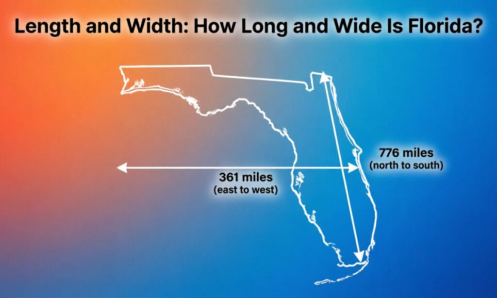
People picture Florida as a skinny little strip of land, and that picture is just wrong.
The state has real length and real width, and both numbers surprise first time visitors every single time.
North to South
Florida runs about 447 miles from the Alabama border down to the tip of the mainland.
Add the Florida Keys and you stretch even further south, with Key West sitting closer to the Bahamas than to Miami in some ways.
Driving from Pensacola to Key West takes over 12 hours without a single stop, which is basically like driving from London to Edinburgh and back again.
East to West
At its widest point, across the Panhandle, Florida spans about 361 miles from the Gulf to the Atlantic side.
That width shrinks fast as you head south, narrowing down to roughly 160 miles at the slimmest point of the peninsula.
This shrinking shape is exactly what gives Florida that long, curved outline you see on every map.
The Latitude Factor
Florida spans from 24 degrees north up to 31 degrees north, which is a 7 degree range.
That gap means the north can get frost in winter while the south stays warm enough for shorts and sandals all year long.
Two cities in the same state can feel like two completely different countries just because of where they sit on the map.
The Florida Panhandle vs. The Peninsula
Florida is not one single place, it is really two different worlds stitched together.
Knowing the difference between the Panhandle and the peninsula will save you from a lot of confused packing decisions.
The Florida Panhandle
The Panhandle is the long strip running west from Tallahassee toward Alabama, and it feels more like the Deep South than tropical Florida.
Towns like Pensacola and Destin serve up Gulf beaches with sugar white sand and water so clear it looks fake in photos.
Winters here are cooler, and the region actually gets four real seasons, something South Florida can only dream about.
The Peninsula
The peninsula is the classic Florida shape most people picture, stretching south between the Atlantic and the Gulf of Mexico.
As it narrows, it slides into the Everglades and then breaks apart into the Florida Keys chain heading toward Cuba.
This is where the postcard version of Florida lives, warm water, palm trees, and endless sunshine.
Elevation: America’s Flattest State
Britton Hill in the Panhandle is Florida’s highest natural point, and it stands at just 345 feet.
Kansas, a state everyone jokes about being flat, actually has a high point over 4,000 feet, so Florida wins the flat contest easily.
If you brought hiking boots expecting mountains, you can leave them at home, because Florida’s biggest hill would not even count as a bump in Colorado.
Florida’s Coastline: The Real Showstopper
Florida’s coastline runs about 1,350 miles, ranking among the longest of any state in the country.
Count every bay, inlet, and winding tidal river and that number jumps to an incredible 8,436 miles of tidal shoreline.
That is the kind of coastal variety that keeps beach lovers coming back year after year.
Gulf Coast vs. Atlantic Coast
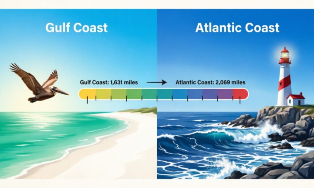
The two coasts are honestly like two different vacations packed into one state.
| Feature | Gulf Coast | Atlantic Coast |
| Water Color | Emerald green, turquoise | Deep blue green |
| Sand Color | Powdery white quartz | Lighter tan |
| Waves | Calm, gentle | More active surf |
| Water Temp | Warmer, 73F to 86F | Slightly cooler |
| Famous Spots | Clearwater, Destin, Naples | Daytona, Fort Lauderdale, Palm Beach |
Famous Florida Beaches
Some beaches here are famous for very good reason, and they earn every bit of the hype.
Siesta Key Beach regularly ranks as the number one beach in the entire country thanks to its powder soft sand.
Clearwater Beach and South Beach in Miami round out the list, one calm and dreamy, the other loud and full of energy.
Everglades National Park: A Wilderness That Defies Description
South of Lake Okeechobee, Florida turns into something you will not find anywhere else on the planet.
The Everglades cover about 1.5 million acres of sawgrass, mangroves, and slow moving water that locals call the river of grass.
Alligators and Florida panthers share this same wild space, and the endangered panther population sits at fewer than 200 animals left in the wild.
This UNESCO World Heritage site also filters drinking water for millions of South Florida residents, so it does far more than just look pretty.
How Florida Compares to Other States and Countries
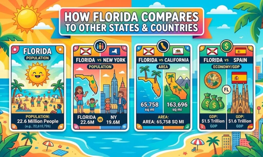
Florida’s total area comes out to 65,758 square miles, and that number beats a surprising list of places.
| Location | Total Area | vs Florida |
| Georgia | 59,425 sq mi | Smaller |
| New York | 54,555 sq mi | Smaller |
| England (UK) | 50,301 sq mi | Smaller |
| Greece | 50,949 sq mi | Smaller |
| Louisiana | 52,378 sq mi | Smaller |
| Pennsylvania | 46,054 sq mi | Smaller |
That fact alone should change how much time you plan to spend exploring here, because this is not a quick weekend state.
Key Geographic Features That Define Florida’s Landscape
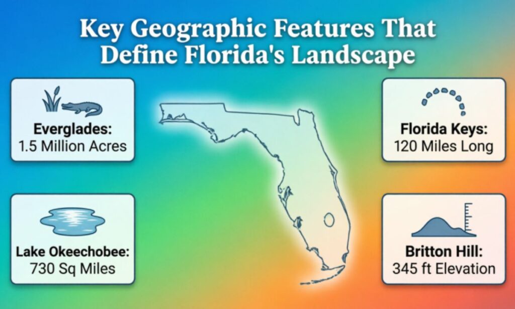
Florida’s landscape is full of quiet natural wonders that most visitors never hear about.
These features shape the water, the climate, and honestly the entire personality of the state.
Lake Okeechobee
Lake Okeechobee is the second largest freshwater lake sitting entirely inside the United States, covering 730 square miles.
Despite its massive size, it only averages about 9 feet deep, making it a giant shallow bowl of freshwater right in the middle of the peninsula.
This lake feeds the Everglades and supplies drinking water to millions of people across South Florida.
Florida’s 700+ Natural Springs
Florida sits on top of one of the biggest aquifer systems on Earth, and it shows in the springs bubbling up everywhere.
Over 700 natural springs dot the state, many holding a steady 68 degree temperature all year long.
Ginnie Springs, Ichetucknee Springs, and Silver Springs rank among the most stunning, with water so clear it looks like glass.
The Central Florida Ridge
A gentle ridge of raised land runs through the middle of the state, topping out around 300 feet.
This ridge forms the backbone of the Orlando area, home to Walt Disney World’s massive 27,000 acre footprint.
Kennedy Space Center adds another 140,000 acres of protected land on the Atlantic side, giving NASA plenty of room to launch rockets safely.
Climate Zones Across Florida’s Length
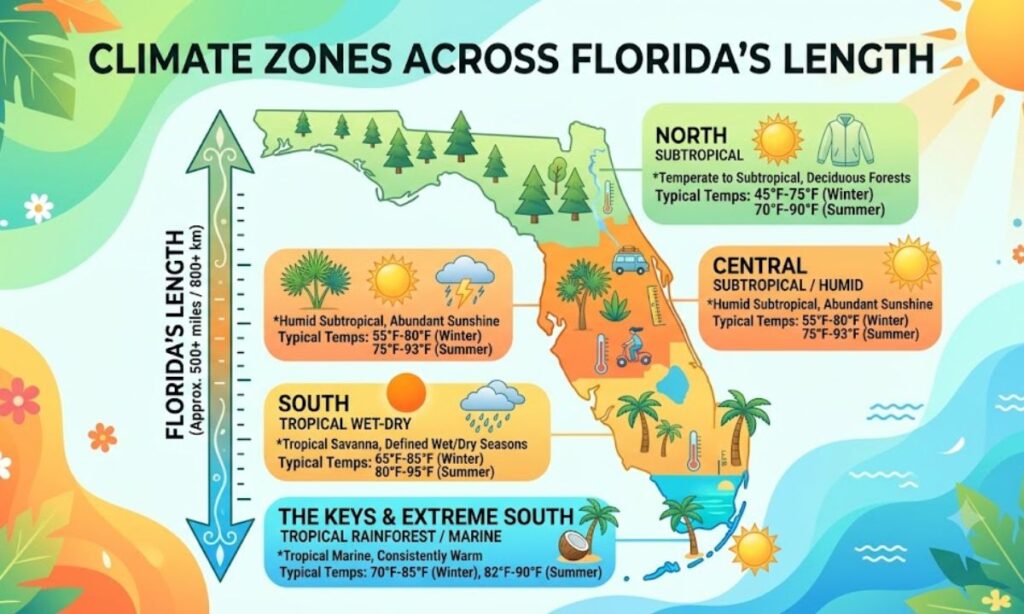
Florida’s long shape means the weather up north has almost nothing in common with the weather down south.
| Region | Climate Type | January Avg | July Avg |
| Pensacola | Humid Subtropical | 52F | 82F |
| Jacksonville | Humid Subtropical | 54F | 82F |
| Orlando | Tropical influenced | 61F | 84F |
| Miami | Tropical | 68F | 84F |
| Key West | Semi tropical | 70F | 85F |
That is nearly a 20 degree gap in the same state, which catches a lot of winter travelers completely off guard.
Pack layers if you are heading north in winter, because shorts alone will leave you shivering.
Population Density Across Florida’s Dimensions
Florida is home to about 22.6 million people, but they are nowhere near evenly spread out.
Most residents cluster along the coasts and the I 4 corridor, the busy highway strip connecting Tampa, Orlando, and Daytona Beach.
Miami’s metro area alone holds around 6.2 million people, making it the cultural heartbeat of the entire state.
Tampa Bay and Orlando follow close behind, each home to millions more residents chasing sunshine and job opportunities.
Jacksonville: America’s Largest City By Land Area
Here is a fact that stops people in their tracks every time.
Jacksonville spans roughly 747 square miles of land, making it the largest city by land area in the entire contiguous United States.
That beats Los Angeles at 503 square miles and New York City at 302 square miles, combined they still fall short.
This happened back in 1968 when Jacksonville merged with the surrounding Duval County in a single consolidation vote, instantly creating a geographic giant.
Notable Universities and Hospitals in Florida
Florida is not just beaches and theme parks, it also holds serious academic and medical weight.
These institutions shape careers, save lives, and add real substance behind the sunshine state reputation.
Top Universities
University of Florida in Gainesville ranks among the top public universities in the entire country, especially strong in research and medicine.
University of Miami in Coral Gables brings global recognition for its marine science, law, and business programs.
Top Hospitals
Mayo Clinic Florida in Jacksonville consistently ranks among the best hospitals nationwide across nearly every specialty.
Jackson Memorial Hospital in Miami serves as one of the largest public hospitals in the country and trains future doctors through the University of Miami’s medical school.
Transportation and Sports & Recreation in Florida
Getting around a state this big takes some planning, and the sports scene here is just as massive as the land itself.
Getting Around Florida
Interstate 95 runs the whole Atlantic side, Interstate 75 cuts through the center and south, and Interstate 10 connects the Panhandle east to west.
Miami, Orlando, and Tampa international airports rank among the busiest in the country, making Florida easy to reach from almost anywhere.
Professional Sports
Florida hosts three NFL teams, the Miami Dolphins, Jacksonville Jaguars, and Tampa Bay Buccaneers, spread across its biggest cities.
The Miami Marlins and Tampa Bay Rays cover baseball, and nearly half of all MLB teams use Florida for spring training every single year.
Outdoor Recreation
With 1,350 miles of coastline, kayaking, paddleboarding, and deep sea fishing draw millions of visitors annually to the Florida Keys and beyond.
The Florida Trail stretches an incredible 1,500 miles across the entire state, giving hikers a true edge to edge adventure.
Florida’s Geography Records Worth Knowing
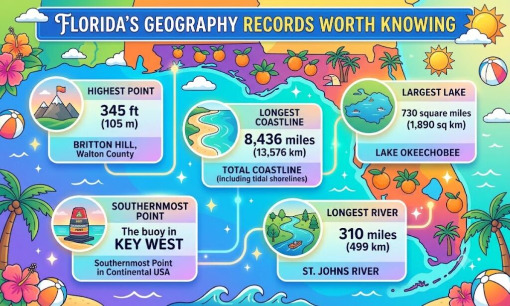
Florida racks up an impressive list of geography records that few states can touch.
• Longest coastline in the lower 48 states
• Flattest state in the entire country, topping out at just 345 feet
• Largest subtropical wilderness in the US, home to the Everglades
• Only state with a living coral reef in the continental US
• Most lightning strikes per square mile of any state
• Largest city by land area in the contiguous US, that title belongs to Jacksonville
• Southernmost point in the contiguous US, found at Key West
• Second largest freshwater lake entirely within the US, that is Lake Okeechobee
• Home to over 700 natural springs, one of the largest concentrations on Earth
• Longest paved hiking trail in a single state, the 1,500 mile Florida Trail
Practical Travel Distances in Florida
Planning a Florida road trip means respecting the state’s real scale, not the tiny version people imagine.
| Route | Distance | Drive Time |
| Jacksonville to Miami | 345 miles | 5.5 hours |
| Miami to Orlando | 235 miles | 3.5 hours |
| Orlando to Tampa | 85 miles | 1.5 hours |
| Tampa to Pensacola | 450 miles | 6.5 hours |
| Miami to Key West | 160 miles | 3.5 hours |
| Orlando to Kennedy Space Center | 58 miles | 1 hour |
Never assume two Florida cities sit close together just because they share a state.
Conclusion
Florida is bigger, weirder, and way more interesting than the postcard version everyone carries around in their head.
From Britton Hill’s tiny 345 foot peak to Jacksonville’s sprawling 747 square miles, this state keeps breaking expectations at every turn.
Next time someone calls Florida just a strip of beach and theme parks, send them this article and let the numbers do the talking.
FAQs About Florida
Does Florida have any mountains or big elevation changes?
No, Florida is the flattest state in the country, with Britton Hill standing at only 345 feet.
Does Florida have a state income tax?
No, Florida is one of just nine states with zero state income tax, which draws millions of new residents every year.
What language is most spoken in Florida after English?
Spanish, by a wide margin, reflecting the state’s deep ties to Cuba, Puerto Rico, and Colombia.